Primož Jakopin, photo diary
From Tamaimo down the Barranco Seco to the Sea
February 11, 2015, 39 pictures
Pictures are 533 by 800 pixels in size, numbers in front of the photo descriptions are serial numbers of the original images.
Photo and copyright (c) Primož Jakopin 2015. Some of the pictures were taken on February 2 and 7.
Barranco Seco
There is no such thing as a free lunch and this old saying is especially valid if you are trying to find a secluded beach on an island as
popular and consequently populated as is the Tenerife. And even more so on its more sunny, southwestern side. But, at a price, anything
can be found.
Such a place is situated between the end of the urbanized
coast from Los Cristianos to Los Gigantes and between the Barranco de Masca
(Masca valley). It is called
Playa de Barranco Seco, or Playa Seco for short. Between Los Gigantes
and Masca there are two ravines, from east to west, Barranco Mancha de Los Diaz
and Barranco Seco. As can be deduced from Gary
Rosson's blog In the Land of the Giants - A Walk to Playa Seco
of May 11, 2011, Barranco Mancha de Los Diaz does not reach the sea on its own but
joins the Barranco Seco, at a distance of
around one hour walk from the sea (estimate of the author).
Playa de Barranco Seco can be accessed by sea from Los Gigantes' marina (3 km),
via a boat taxi to Masca, for a cost of 10 euros (2015), equal price as
is the fare to Masca (the same direction, but 5 km). The only problem
is, as there is no pier at Playa de Barranco Seco, the beach is
officially closed because of falling stone danger, that you have to
disembark by jumping into the water and embark in a similar manner.
Not a particularly attractive option, especially not in winter or
if you have a backpack.
So a terra firma access was also investigated and a suitable report finally found:
Hiking Los Gigantes, Tenerife, published
by Dawn Westrum on December 23, 2011. As it turned out the walk from
Tamaimo (610 m a. s. l.) to the tunnel is less than half an hour, the
tunnel takes 20 minutes, and the hike from the tunnel (at 480 m a. s. l.)
to the sea took 2.5 hours, could be much less but in many instances the signposts,
stone cairns on the rocks, were misleading, and this caused waste of
time, lost in searching the proper direction again.
The original old trail,
from the times when the Barranco Seco was much more in use than it is
now, well laid with small supporting walls here where required,
laso suitable for donkey or equestrian traffic, is
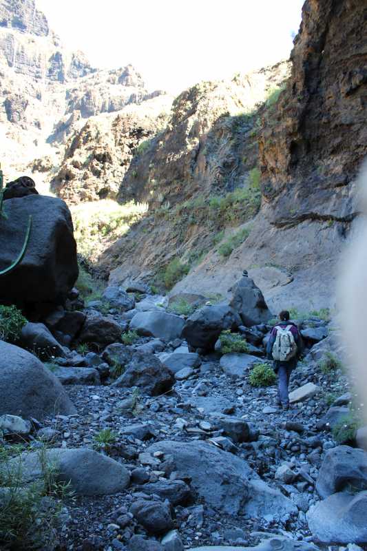
nowadays very much overgrown. It crosses the stream bed - the stream is active
only after major rains, during the trip there was only a trickle here
and there - several times, as the trail always follows that side of
the Barranco, either southern or northern, which has smaller
inclination in that section. It certainly never follows the stream
bed, because the latter is regularly interrupted by a vertical drop,
too high and steep to climb and also without a suitable detour in the immediate
vicinity. So it was fairly easy to advance while the trail zigzagged
on a slope, but where it crossed the stream bed you were immediately in trouble.
People who walked the trail before took a wrong direction, often
not a single one, and marked it well with new cairns, while the old
were either overgrown or destroyed by the ravages of time. So one has
to go back to the stream crossing and search for old clues in the
bush. Twice the old trail abruptly comes to an end at the edge
of a precipice, where the continuation is clearly visible on the other side
of the narrow canyon, maybe only 5 or 6 meters away. Clearly a bridge,
now missing, was once here. A jump over is very tempting ... but
a long detour certainly wins in the end. The second such missing bridge is just
at the last bend of the valley before the sea.
What were the most important observations, what
changed since 2011? The first tunnel, described in
Hiking Los Gigantes, Tenerife
is slightly longer than previous estimate,
at 1,300 meters, is still open, while the second, open in
2011, is now locked. On the new table at its recently
repainted southern gate there is also the info about its length, 1,922 m.
Water in the valley - there are places in the stream bed where water
can be found, even some small current among the rocks here and there,
but the white mineral residue on the rocks demands some caution
before drinking.
The trail down the barranco is also much more overgrown than it was in
2011 and will, without a substantial cleanup,
soon be turned back to pristine condition, be claimed back by the wilderness.
During the trip no other traveler was encountered
in the barranco, besides some bird calls the only other living
voice was an echo of a distant conversation heard below the tunnel on
return. It was unclear where it came from, possibly from above, from
the ridge above the ravine. The ruins of long-ago abandoned shacks
in the cliffs above the barranco, remains of some distant mining
projects, one opposite the place where a dry bed of a small side stream,
coming from below the tunnel, joins the ravine bottom, the other
at the northern end of the 1.922 m long locked tunnel, in the
southern wall some over halfways down the ravine, the cliff faces
looming high above, all add to the eerie, apocalyptic,
Treasure of Sierra Madre feeling of the place.
But the sunlight, descending down the sides of the barranco
as the day moves on, and the view west, towards the sea, which is
first seen as a small triangle above the ravine bottom but grows
bigger and bigger, with the sight of cloud-capped La Gomera island in the distance, both
reveal the actual grandeur of the valley and intensify
the impression that it is after all a very delightful trip.
Starting early is most recommended to avoid a hurried and panicked return,
the trail is also not for the faint-hearted, the tunnel at the
beginning may seem sinister and never-ending to non-cavers, in the canyon
there are detours which can have a short pitch of grade 2-3 free climbing,
during the summer months the place is probably very hot, but in
general it is a wonderful, most affordable adventure, and only minutes from the
hustle and bustle of Los Gigantes riviera.
Unforgettable.
From Tamaimo through the Tunnel
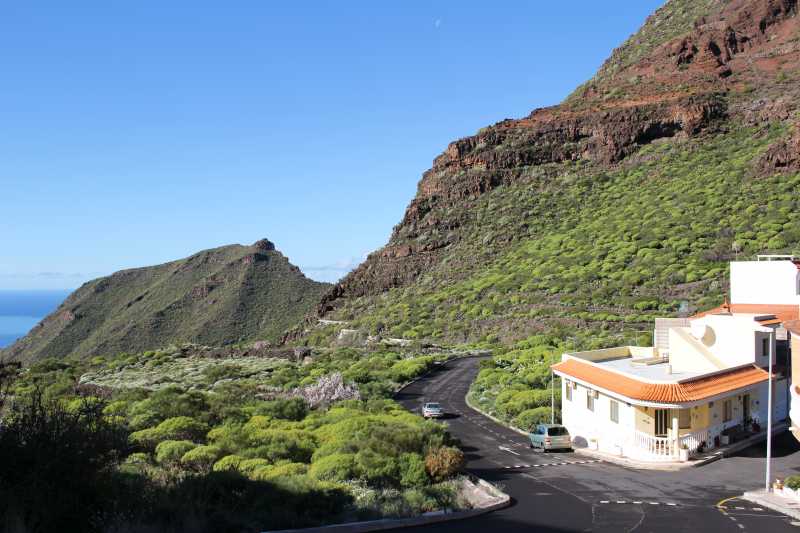
24536. On the western flank of the town, below the parish church of Santa Ana, a steep paved road descends to the plain below the mountains, shown in the picture. There is a lane with newly built homes at the right, and the road at the left (with two parked cars) is blind and ends very soon, at the edge of a dry stream with smooth lava rocks. Here the trail from Los Gigantes to Santiago del Teide is passing by. At the Santiago del Teide / Los Gigantes signpost turn left, down, towards Los Gigantes.
24537. After a little while the trail is passing through the yard of the only house, a goat farm. They also have many cats.
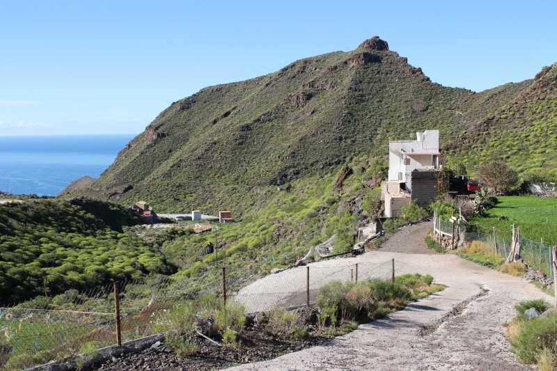
24539. After another 10 minutes walk a large gravel embankment is to be seen at the right. There are just two such embankments on the tral from Tamaimo to Los Gigante, and both are made of material from the tunnel digging. Here the tunnel is behind the first roofless building.
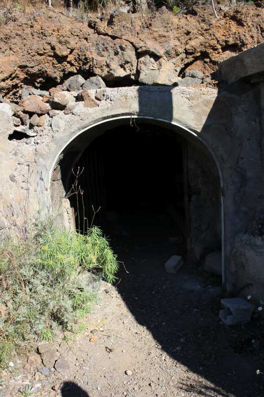
24540. Southern entrance to the tunnel. It has old gates, but they are wide open and look to be in that position for many years.
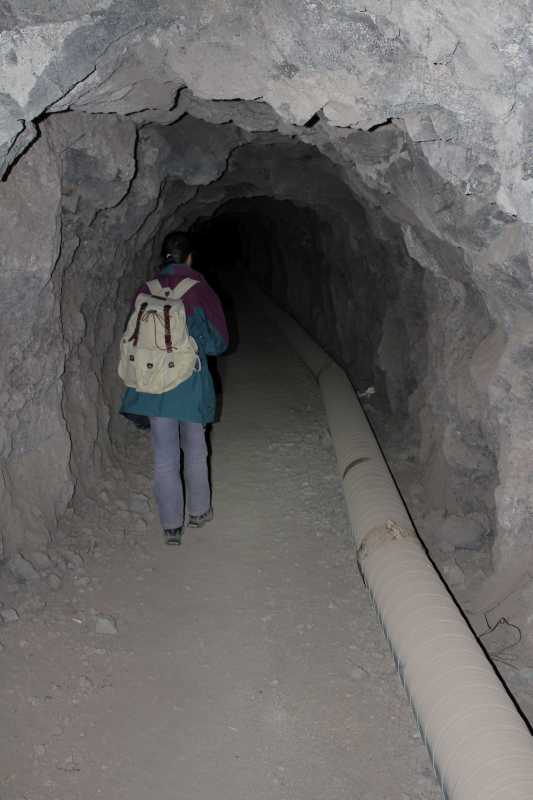
24541. The first few hundred meters of the tunnel are without rails - they were probably removed for scrap iron as it was not too difficult to carry them out. At the right side is the outer layer of a water tube which extends to about 3/4 of the tunnel. If it would be complete the tunnel would very likely be locked, as is the second, 1,922 m long down the trail to Los Gigantes.
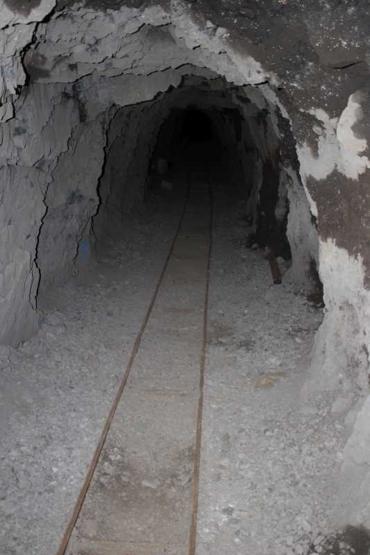
24542. Towards the end of the tunnel the tube is gone. The rails were used for carts, used to transport the excavated rocks out of the tunnel.
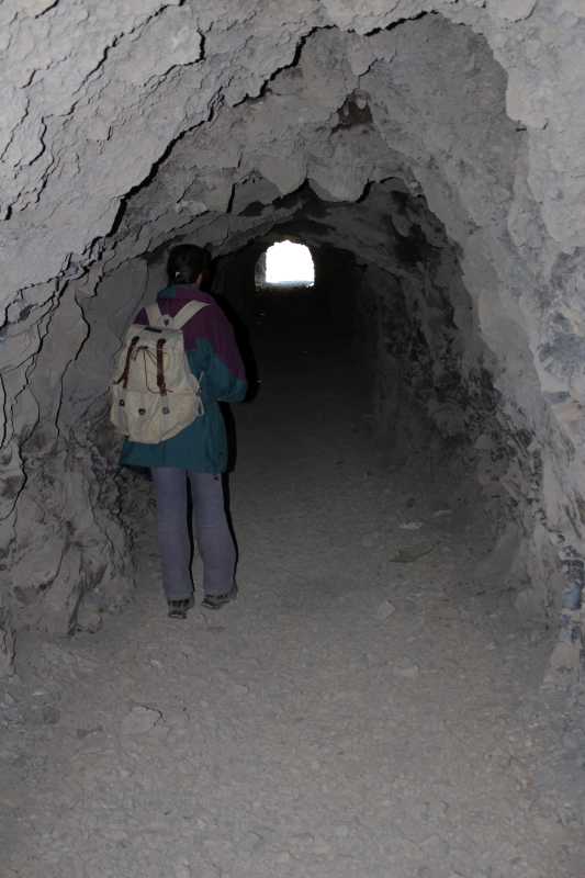
24543. Some 300 meters before the end the tunnel makes a slight right turn, descends by about a meter, and turns slightly left again. In the picture: the last stretch of the tunnel before the northern exit. Tunnel height is mostly high enough for walking, has about 2 meter clearance, but a rock here and there can be lower, down to 1.8 meters, so care and a good hat is recommended.
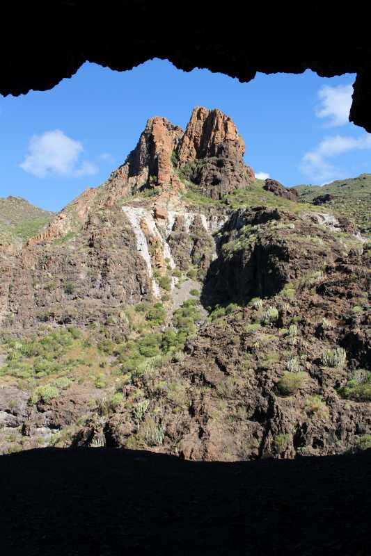
24544. View through the northern entrance with the cliff and the pinnacles on the other side of the ravine
Barranco Seco
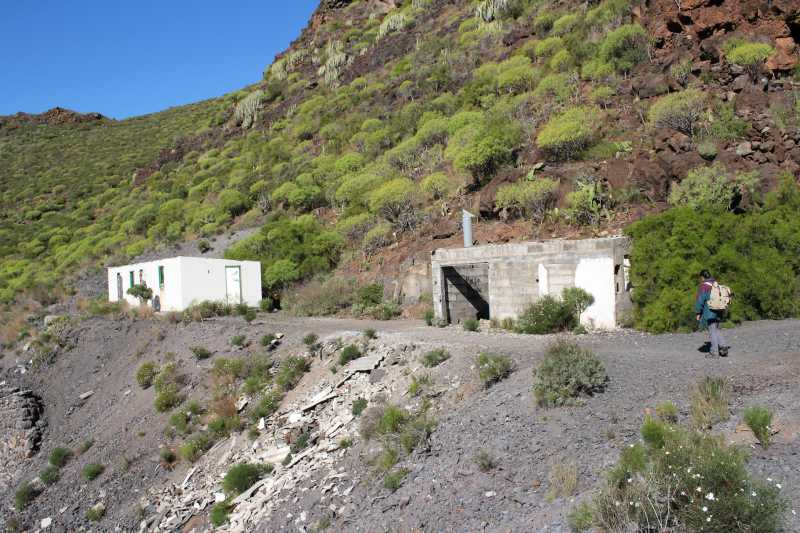
24661. There is no large embankment below this entrance, so the tunnel was mostly dug from the south. There is no good trail visible so the descent down the gravel slope seems most natural, and was also used. But it is not the best option, it comes to a drop in the stream bed with a steep detour. On return a better direction was discovered, to the left ...

24660. ... shown here. It passes laterally in the western direction,
till the edge in the picture, where it starts to descend. It is marked by cairns, but the trail is also well discernible.
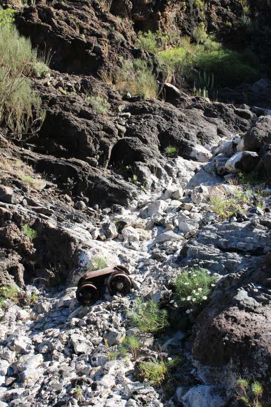
24545. Wheels and undercarriage of a mining cart from the tunnel, thrown from the entrance and brought some lower by the flooding water.
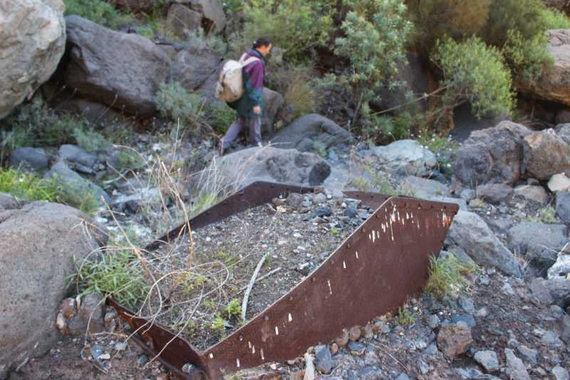
24546. Cart's cargo container in the gravel, filled and overgrown
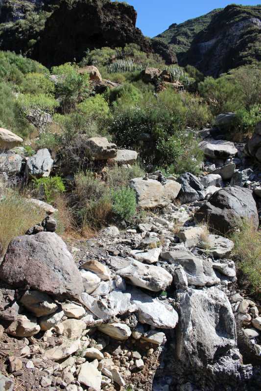
24547. View up the barranco bed
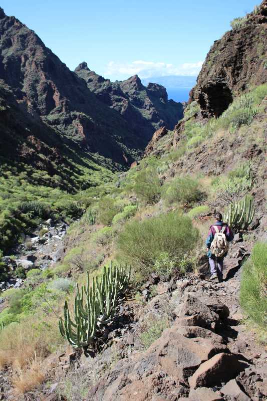
24549. View down the ravine and the trail, supported by the side by a line of rocks; the sea nad La Gomera in the distance

24550. Cliffs on the northern side of the barranco
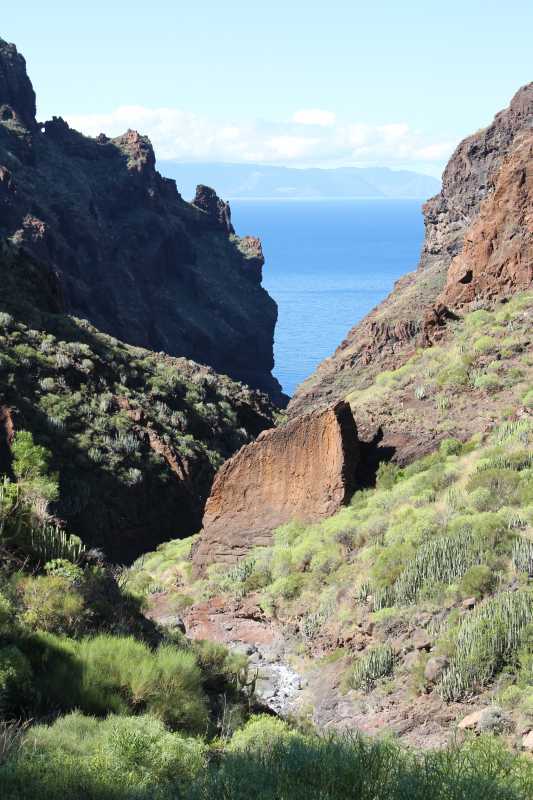
24551. Another view west to the sea, about an hour from the coast, with a large brown rock as a signpost
24552. A detour where the bridge in the old trail is missing, marked by a cairn on the rock center right. Cairns usually follow the stream bed, but is not a good option,they inevitably lead to a problematic drop, it is better to locate the old trail again, as soon as possible.
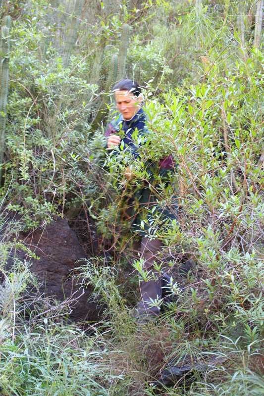
24553. In places the old trail is so overgrown by branches and vines that you have to force your way through.
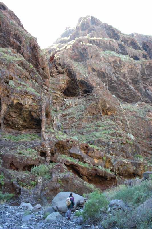
24554. Toward the end of the trail the sides of the barranco are getting nearly vertical - the southern (left) side above the ravine bed
The Bay
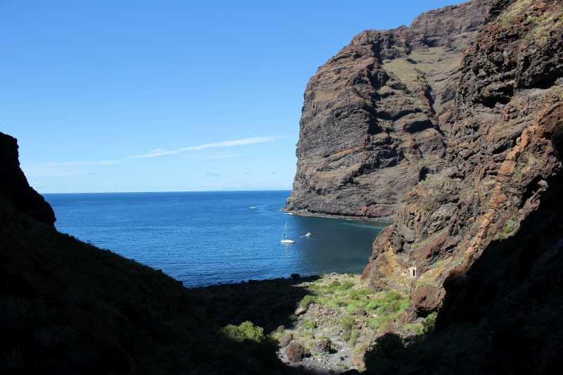
24556. View of the bay with Barranco Seco beach from the trail, at close distance
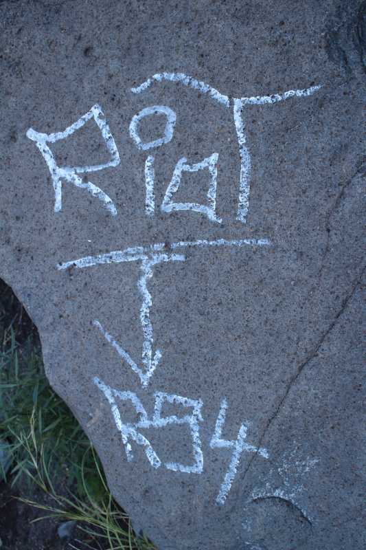
24557. RioT R54, inscription on the rock
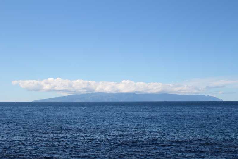
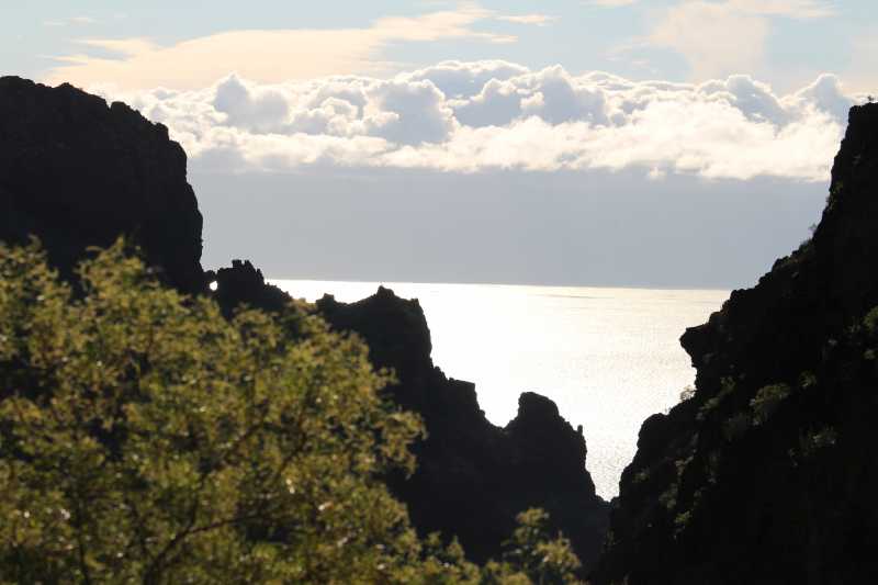
24559. View of La Gomera island, 30 kilometers away, with a cap of clouds
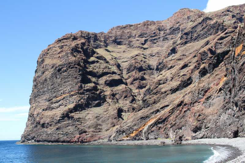
24560. Northern side of the beach with one of the Los Gigantes mountain ridges, falling precipituously into the sea
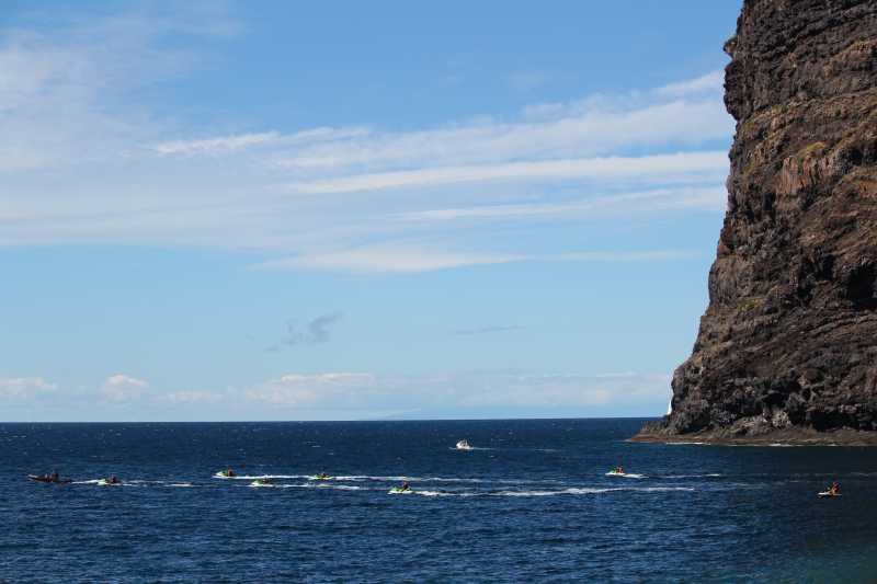
24563. A fleet of scooters with a guardian, the escorting rubber powerboat in front
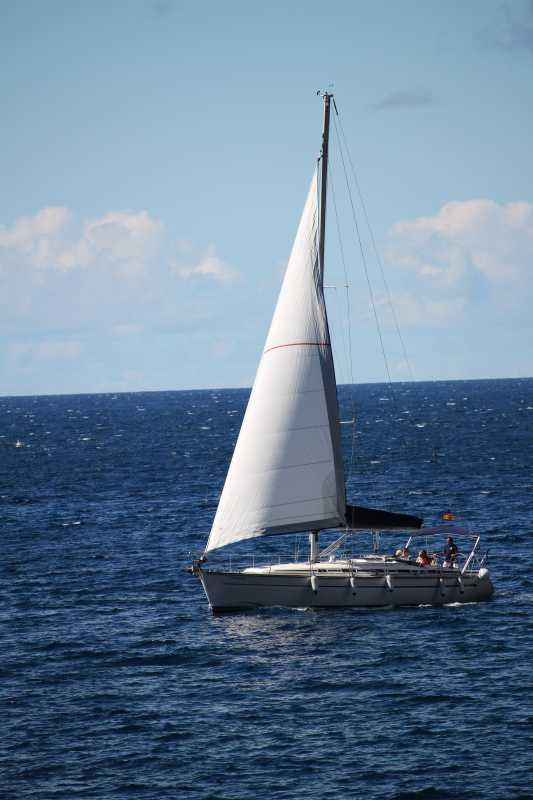
24566. A rare sailing boat, the only one seen that day under sail
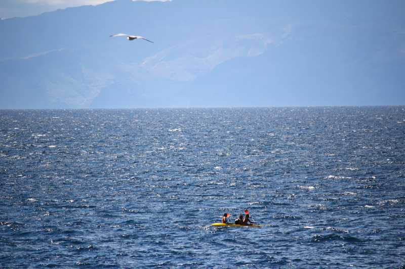
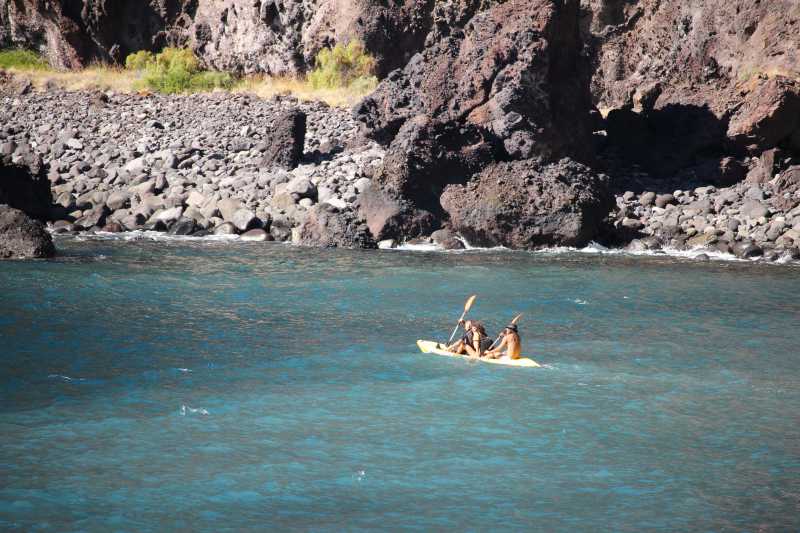
24569. A telephoto view, at a distance of around 500 meters, of a seagull above a small canoe with two men paddling and a woman in between; La Gomera is in the distance.
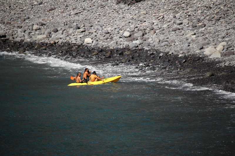
24573. Canoe, landing at the beach
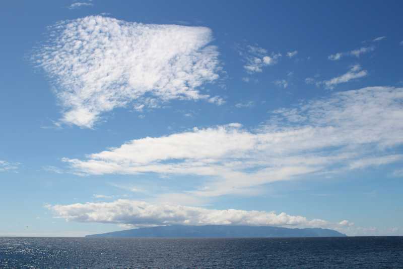
24578. Another view of La Gomera and the clouds
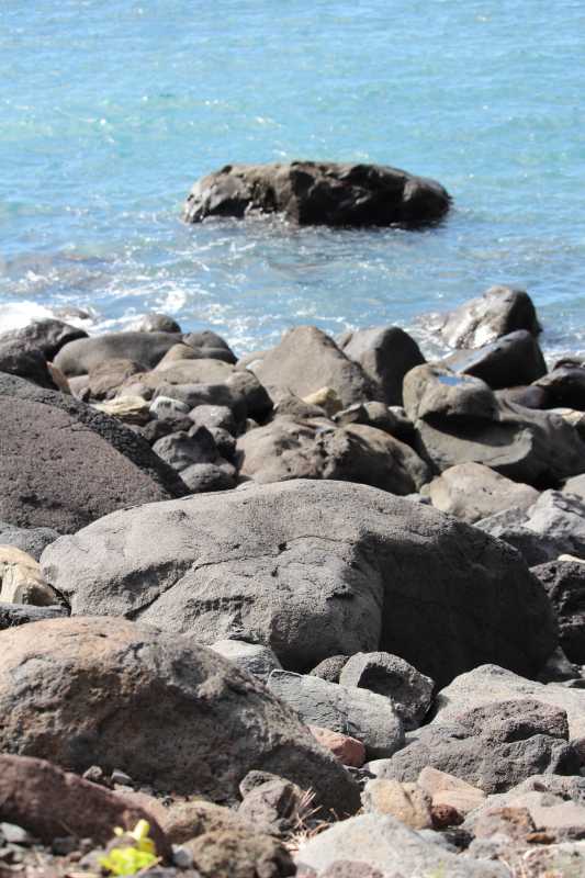
24581. The coast of the bay is of big rocks in the south and of sand with large pebbles in the north
24583. Canoe, departing

24585. View of the southern side of the bay, from the opening between the cliff wall and a large rock, leaning against it
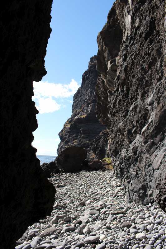
24587. View north from the opening
The Way Back
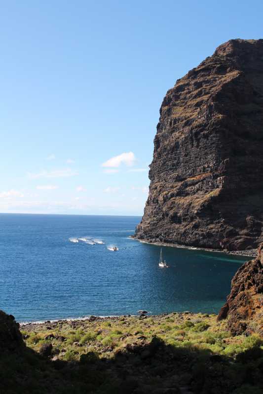
24590. View of the bay with a motoring sailboat and another group of scooters, led by an escorting rubber powerboat
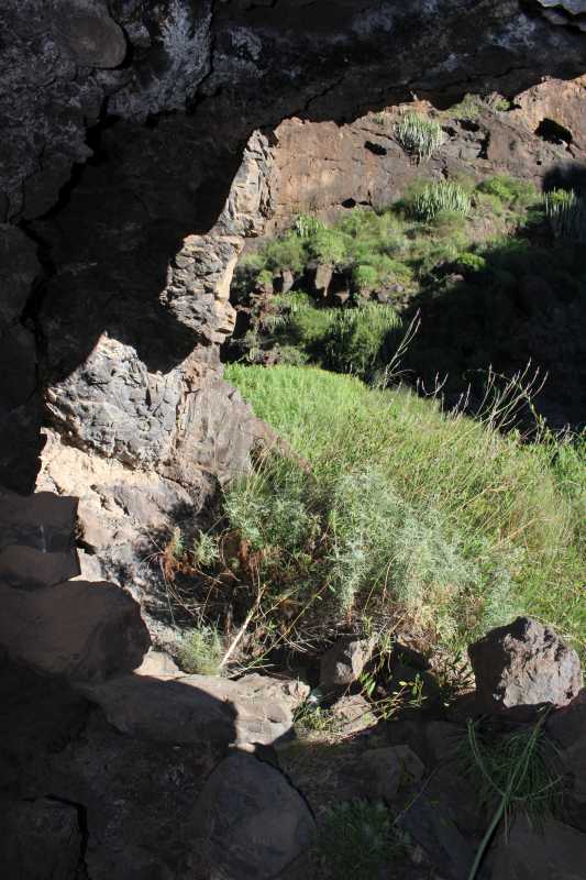
24619. View out from a small cavern, which had a floor built of stones.
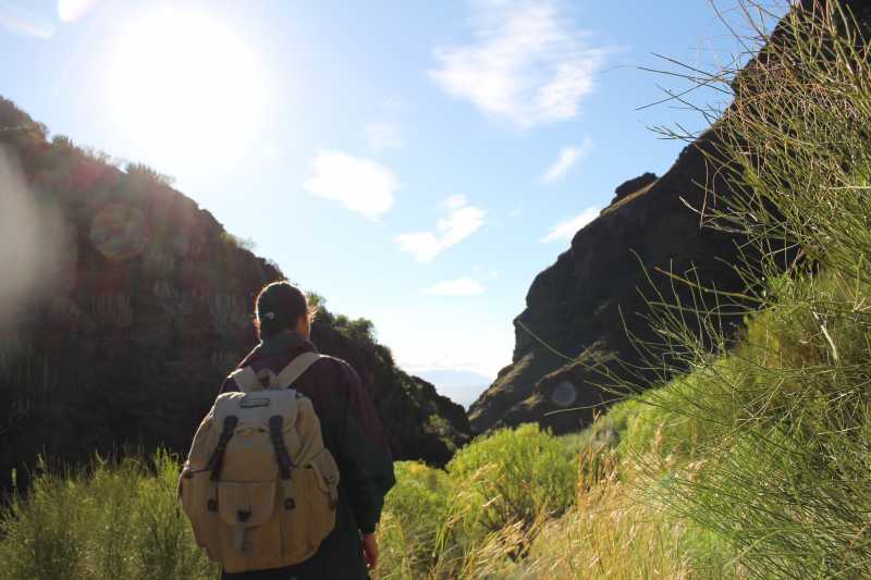
24621. The trail follows eastern or western slope of the valley, always the one with lesser inclination.
24625. View back, down the valley toward the sea with La Gomera island and the clouds
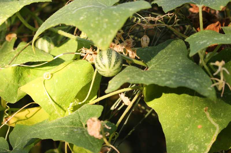
24658. In the bush here and there were climbing plants with fruit in the form of watermelon-coloured balls, just of a table-tennis ball size.
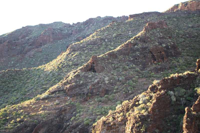
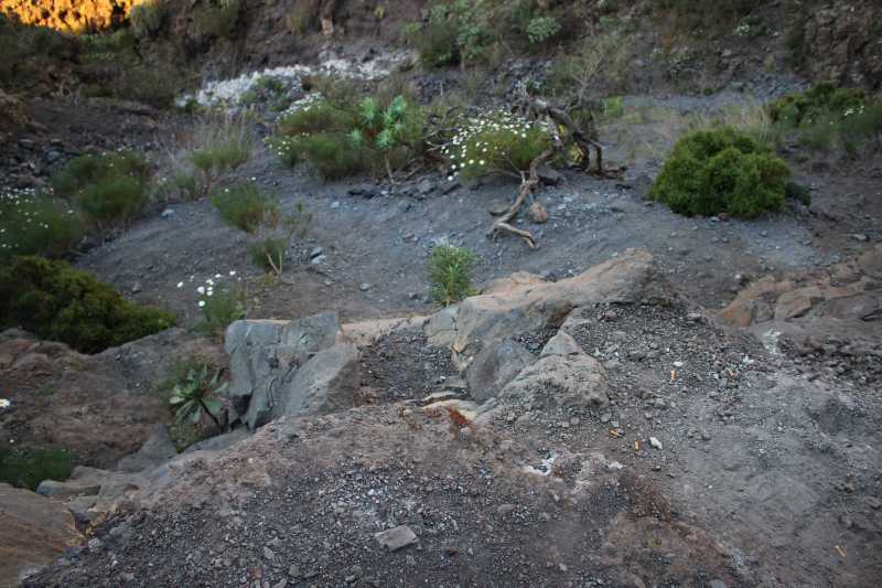
24659. Late afternoon sunrays on the side ridges of the spine between the Barranco Seco and Barranco de Masca
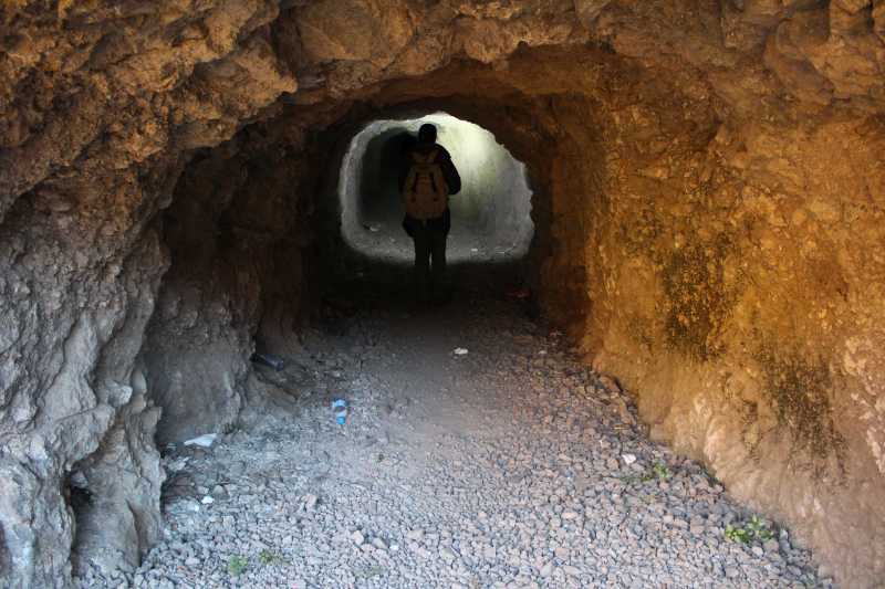
24662. View in the tunnel on the way back, from the western entrance
 Cueva de San Marcos, February 10, 2015

This page and the photos by Primož Jakopin;
send inquiries and comments to
primoz.jakopin@guest.arnes.si.
Page initiated on February 24, 2015; date of last change March 2.
URL: http://www.jakopin.net/primoz/slike/2015/PJ20150211_en.html
