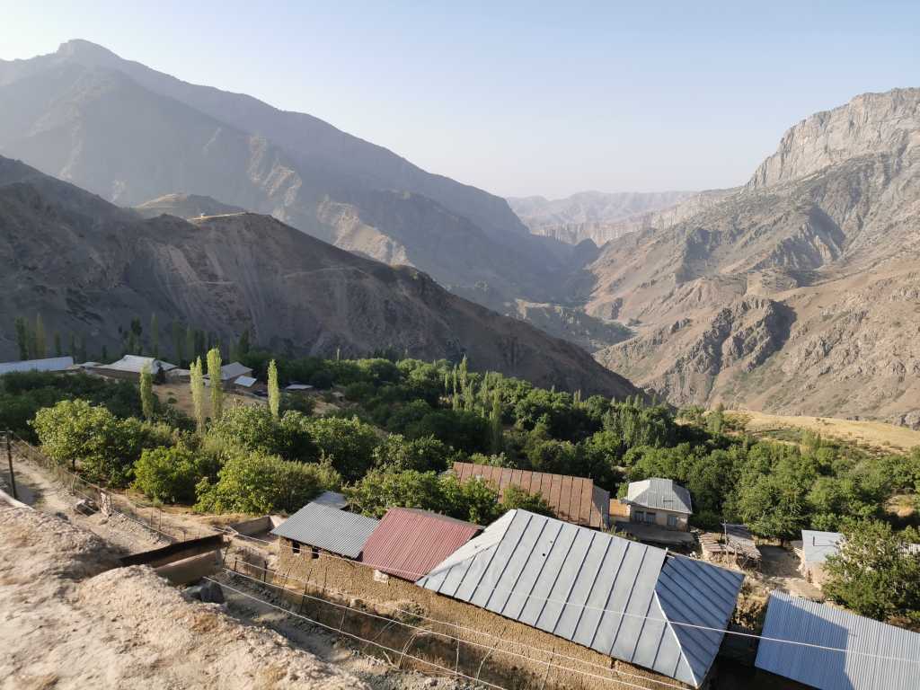
50232. Morning view from the lower Dehibolo road to the east, Holidin's summer home is hidden just behind the saddle on the first hill on the left.
Most images are approximately 683 x 1024 pixels in size,
numbers in front of the picture descriptions are serial numbers of the original photo files.
The page, text and photos copyright (c) Primož Jakopin - Klok 2021, except 50263, where the
credits go to Holidin Kudratulaevič Poënov.
50232. Morning view from the lower Dehibolo road to the east, Holidin's summer home is hidden just behind the saddle on the first hill on the left.

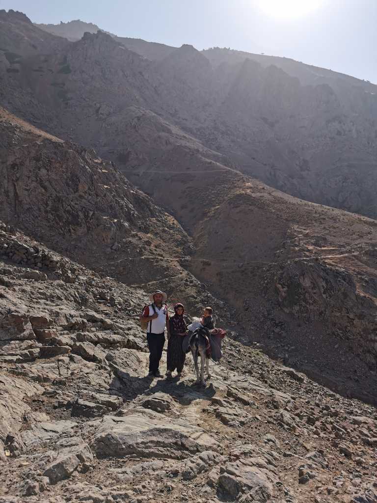
50233. Parviz, his son, is having a snack, in the saddle of a donkey who is having a drink.

50234. View of Dehibolo from the east, below the Chul-Bair mountain ridge on the right, while Hodja-Gur-Gur-Ata ridge is far left.
50236. Holidin, Dilfuza and Parviz on the trail to the summer home, from afar ...

50238. ... and up close

50239. Another view of Dehibolo from the east, from the greater distance

50240. On the trail which leads to the summer home (middle right)

50241. Cat on the patch of sun in the summer home's living room

50242. View east over the valley with orchards and vineyards on its slopes, where the water for irrigation could be flown down the sources in the mountain, via polyethylene tubes.

50243. Two donkey riders and a pedestrian on the trail, cut into the hillside

50244. Zainurali on the donkey and Holidin in a walnut tree shadow
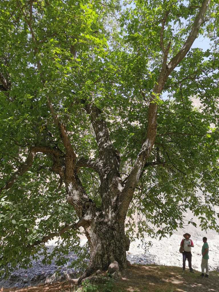
50247. Holidin with a friend below a 500 years old walnut tree, in a walnut grove

50248. People built a small dam on the creek to make a little pool for children to play.

50249. Holidin, Zëratullo and Zainurali on a trail at the side ...

50250. ... of a small creek in the valley, about 1650 meters above se level.
50251. From time to time a tributary from the northeast, from below ...

50252. ... the Chul-Bair, opened up.
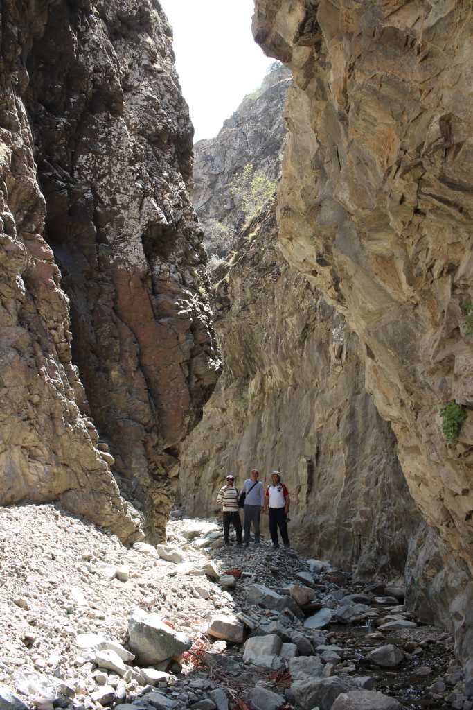
50253. Soon the sides of the valley got closer, it became a canyon - here with Zëratullo, Zainurali and Holidin.

50254. The canyon meandered, ...

50255. ... there were small rapids, which ended ...

50258. ... with a waterfall, ...

50257. ... which was not possible to pass. Yet a trail in the left side of the valley was seen above us ...

50261. ... which we tried to reach by climbing a fault in the side wall.
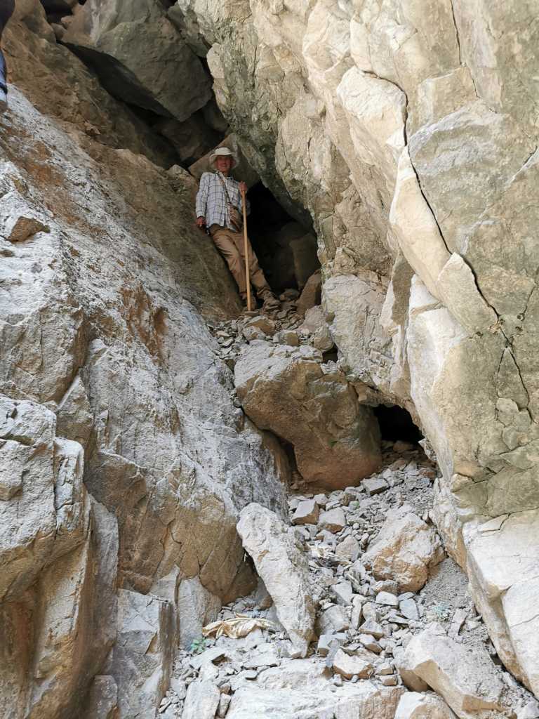
50263. The author in the fault, photo by Holidin; published with permission.

50266. View out from inside the overhang: Holidin, Zëratullo and Zainurali
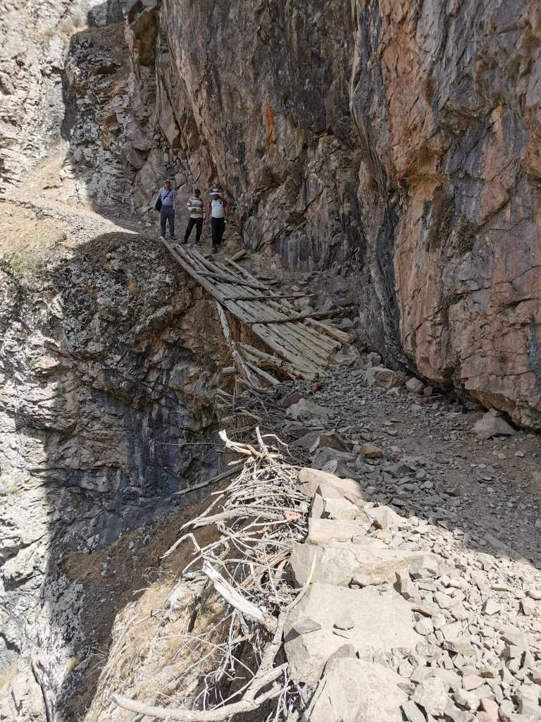
50268. Wooden bridge on the high trail

50269. View out through the door of the main room in the summer house where we paid a visit.

50270. View down the valley with Chul-Bair ridge in the background and beehives at the bottom

50271. A tiny irrigated field with quite a few useful crops: pumpkin, potato, corn and sunflower

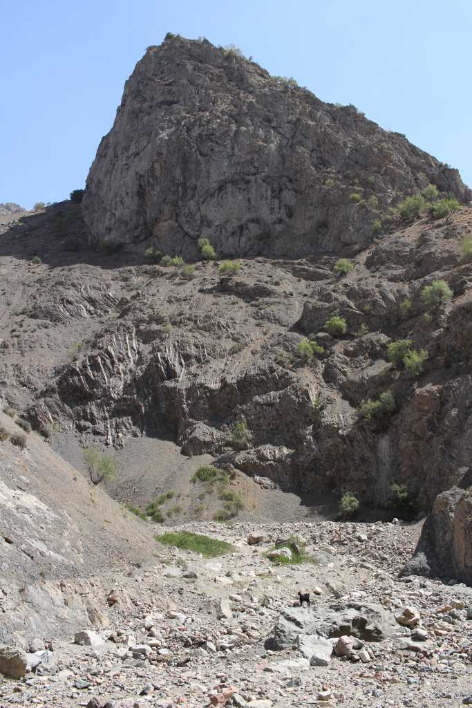
50276. View of the side tributary down the slopes of Chul-Bair with a suspicious shadow which looked like a cave.

50273. A phone telephoto view of it ...

50274. ... and as close as it gets. Will have to be inspected tomorrow.

50275. View of Dehibolo (center left) and Chul-Bair with Hodja-Gur-Gur-Ata in the background

50281. - 50285. A panoramic view of the Chul-Bair ridge, from Dehibolo (left bottom) to the northwest. A click on the photo brings it in full resolution.

50279. More narrow view of the Chul-Bair

50286. Holidin, resting. It was over two hours of ascent, across more or less steep slope, over goat trails.

50289. Cottonthistle, probably of the genus Onopordum

50291. Panoramic view of the Kušona ridge to the southeast of Chul-Bair, the last one before the plain in the extreme south of Uzbekistan, with the peak at about 2800 m a. s. l., as seen from the saddle at about 2300 m.

50294. Sunny ridge sides and shadows with a horizon, jagged by sparse, mostly coniferous (pine) trees.
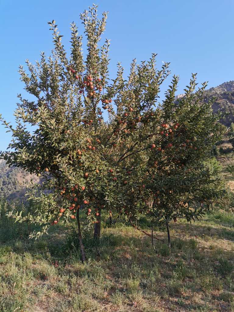
50295. Zëratullo family apple orchard. Apples are red now, when ripe at the end of September they will be black.

50296. Zëratullo and Holidin on a rock outcrop with Chul-Bair in the background

50297. Last sunrays on top of the slope to the south, with the rising moon

50298. View west along the valley with scattered summer homes and orchards, Zëratullo's home is at the bottom of the photo.

50299. The Zëratullo family on the plateau adjacent to the house, with their friend: Binëmin, Abdukuduz, Zulhumor, Gulagse and Holidin
Related posts:
 Dehibolo, August 14 and 15
 Boj-Bulok 2021 : Introduction
The waterfall gorge, Mustafo's son and grandson, August 17
Boj-Bulok 2021 : Introduction
The waterfall gorge, Mustafo's son and grandson, August 17

This page, text and photos by Primož Jakopin,
member of the Ljubljana Cave Exploration Society (DZRJL).
Send inquiries and comments to primoz jakopin guest arnes si
(insert dots and at sign as appropriate).
Page initiated on October 17, 2021; date of the last change: November 9, 2021.
URL: https://www.jakopin.net/primoz/slike/2021/PJ20210816_en.php
481